The Moki Dugway is a section of the Utah state route 261. The winding road descends a height of approx. 335 m (1,100 ft) over a length of 4.8 km (3 miles).
This image is a cropped and tuned version of this spherical image.

This is the blog of the PanoTwins
Articles related to the Sony α 900 camera. Mostly panoramas taken with the camera and usually a ‘shaved’ version of the Sigma 10mm/f2.8 fisheye lens. ‘Shaved’ in this context means that I removed the metal sunshades of the lens with a saw. Now I have a 180° fisheye along the longer side of the sensor.
The Moki Dugway is a section of the Utah state route 261. The winding road descends a height of approx. 335 m (1,100 ft) over a length of 4.8 km (3 miles).
This image is a cropped and tuned version of this spherical image.

This image is a reprojected version of the panorama Kaiser Wilhelm Memorial Church in Berlin. The projection is “stereographic up”.

 Show on map
This image shows a reprojected image of the panorama Heini Klopfer ski jump (at the base). The projection is “transcverse mercator”.

 Show on map
This image shows a reprojected image of the panorama Heini Klopfer ski jump (at the base). The projection is “stereographic down”.

 Show on map
This image shows a reprojected image of the panorama In the Breitachklamm. The projection is “transverse mercator”.

 Show on map
This image shows a reprojected image of the panorama Following the Educational Trail. The projection is “stereographic down”.

 Show on map
Recently we had equinox and as we are living on the northern hemisphere it was spring equinox. Traditionally this is the time when we go out and shoot a panorama for the World Wide Panorama (WWP). An event where we regularly contribute since 2005. The theme of the event was “paths”. Thinking about “paths” I finally thought of educational trails (Lehrpfad in German literally translates to educational path) which are very common in Germany. I did a search on educational trails in Frankfurt and found an educational trail of the faculty of geosciences/geography at the University of Frankfurt/M.
As I followed the trail I did several sphericals. The one I finally chose for the event shows a lovely spot near the old village center of Niederursel a district of Frankfurt/M.

You can view the panorama “Following the Educational Trail” on the pages of the World Wide Panorama (WWP).
 Show on map
This image shows a reprojected image of the Tunnel View in Yosemite Valley. The projection is “transverse mercator”.

 Show on map
This image shows a reprojected image of the view of Monument Valley near Cly Butte. The projection is “stereographic down”.

 Show on map
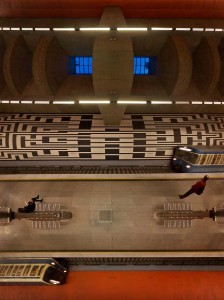
This image shows a reprojected image of the subway station Oberwiesenfeld in Munich. The projection is “transverse mercator”.

When I first saw this reprojection it suddenly reminded me of the computer game Frogger (sic, I’m gettin’old…).
 Show on map