The Shrine of Remembrance is a memorial for all Australians who have served in war. This panorama shows the entrance area of the visitor center.
Technique
The shooting was done with a 2.60 meter (appx. 8.5 ft) pole to reach a more elevated viewpoint. The lens was mounted with a custom-made bracket. Stitched from five images taken with a Walimex (Samyang) 7.5mm fish eye lens on a Sony QX1. Four images around and an additional image for the nadir. The zenith was retouched by hand in post-processing.
Melbourne Central with Shot Tower
This image was taken inside the shopping area of Melbourne Central. The central feature is Coop’s Shot Tower under it’s conical glass roof. The tower is registered as a heritage building in the Victorian Heritage Register.
Technique
The shooting was done with a 2.60 meter (appx. 8.5 ft) pole to reach a more elevated viewpoint. The lens was mounted with a custom-made bracket. Stitched from five images taken with a Walimex (Samyang) 7.5mm fish eye lens on a Sony QX1. Four images around and an additional image for the nadir. The zenith was retouched by hand in post-processing.
Colonnade at new portal of main cemetery
The new portal of the main cemetery of Frankfurt am Main was built 1908. It incorporates a chapel, a crematorium, a morgue and a hall to host funeral services.
Technique
The panorama was taken with my double monopod construction which was extended to a height of approx. 2.5 meter (appx. 8.2 ft). Stitched from four images taken with a Walimex (Samyang) 8mm fish eye lens on a Sony A7. I took four images around and an additional shot for the floor.
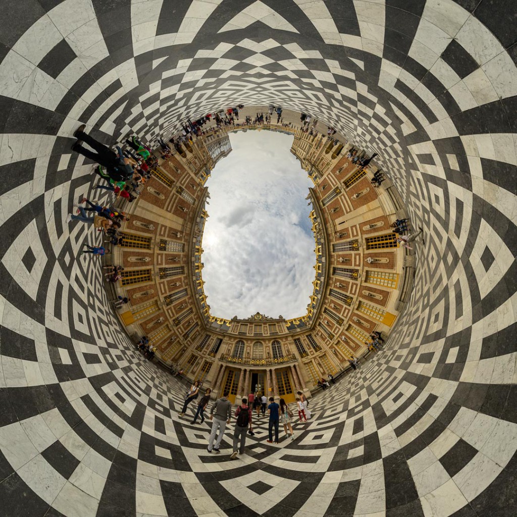
Reprojected Marble Courtyard in the Castle of Versailles
This image is a stereographic up reprojection of this spherical panorama.

Ruin of Anhalter Bahnhof (2)
The ruin of the Anhalter Bahnhof is the remaining structure of a former railway terminus in Berlin, Germany. It was severely damaged in World War II, and finally closed for traffic in 1952.
[pano file=”https://www.panotwins.de/wp-content/panos/JMatern_140916_2909-2912_RM.xml” preview=”https://www.panotwins.de/wp-content/panos/JMatern_140916_2909-2912_RM.jpg”]
Ruin of Anhalter Bahnhof (1)
The ruin of the Anhalter Bahnhof is the remaining structure of a former railway terminus in Berlin, Germany. It was severely damaged in World War II, and finally closed for traffic in 1952.
[pano file=”https://www.panotwins.de/wp-content/panos/JMatern_140916_2903-2906_RM.xml” preview=”https://www.panotwins.de/wp-content/panos/JMatern_140916_2903-2906_RM.jpg”]
Marble Courtyard in the Castle of Versailles
Stitched from four images taken with a Walimex (Samyang) 8mm fish eye lens on a Sony A7. Handheld over the head as tripods or monopods are not allowed inside the Castle of Versailles. Had to do some serious retouching at the tiles of the floor.
[pano file=”https://www.panotwins.de/wp-content/panos/JMatern_140906_2751-2755_RM.xml” preview=”https://www.panotwins.de/wp-content/panos/JMatern_140906_2751-2755_RM.jpg”]
World War I Ruins @ Stilfser Joch (2)
World War I Ruins @ Stilfser Joch (1)
Bürgersaalkirche – Reprojections
The WWP event 614 has the theme ‘Work’. I participated with this submission. The event is scheduled to go online on 8/Jul/2014.


 Show on map